“Mappa Mundi” – Latin for Map
“Mappa” – Latin for Napkin or Cloth
“Mundi” – Latin for World
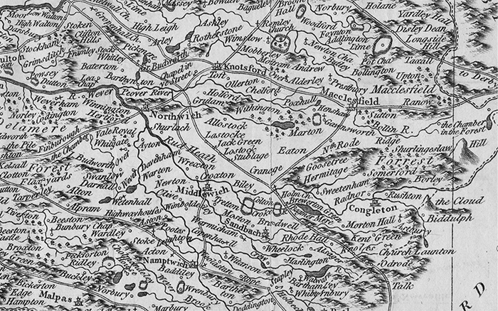
As an architect, collector and history enthusiast, maps appeal to me in a variety of ways. They contain an incredible amount of detail, craft, and precision, but often remain delicate and personal. Like many others, I find myself particularly attracted to maps that originated prior to the digital era. Their creators, known today as cartographers, were expected to follow particularly high standards of technical accuracy.
Most early charts and atlases gave direct feedback about the means of transportation, territorial borders, political hierarchies, economic influences, and geographic features of a particular region. As the art of cartography progressed, new advancements in geology, oceanography, and astronomy began to add new layers and eventually generated entirely new types of maps. While this information was essential to various readers, other important features were far less tangible and required subtle clues. In order to truly master the overall feeling of a location, the cartographer had to inject his or her personal touch while simultaneously characterizing the ethnic, religious, and cultural preferences of the people. Symbols, diagrams and artistic sketches helped the mapmaker tell a story beyond the simple facts and figures of their society.
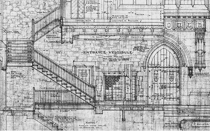
Architectural drawings of the past are just as interesting, and often for the same reasons. Like old maps, they were two-dimensional images of a three dimensional object or space in which some amount of variation was accepted by both the artist and the viewer. While mapmakers struggled to determine what amount of distortion was permitted when translating the curvature of the earth and the heavens onto a flat surface, architects and master builders proceeded to develop abstract drawing methods (the plan, elevation and section) to represent their original concept without reducing the accuracy displayed in the document. Both artists tried to transport their reader to a specific time and place, and their most successful works struck a delicate balance between detailed accuracy and artistic expression.
The artist’s ability to depict details was often what separated a skilled architect or mapmaker from an amateur. With talent, experience and careful delivery, the documents themselves began to provide an intimate scale and evoke a sense of time and place. This not only made the map or drawing more interesting, but it helped to properly represent the character and culture of a particular place or region.
There is, however, one notable difference between old maps and architectural drawings – their concept or origination. Although similar in craft, methodology, and representation, most maps were simply honest depictions of what already existed, while drawings were a new idea of what could be created. They were not simply a recording, but an imagination of what the artist wanted others to experience. Most architects knew how to provide the necessary details for construction, but only the most skilled designer knew how to represent the details in such a way that the readers could transport themselves into the future and build off the ideas of the creator. Staring into an old blueprint not only conveys a certain time and place, but it elicits a sense of awe. It is inspiring to know that a long time ago, someone sat down with a napkin or cloth, and created a world that we can experience today.
